
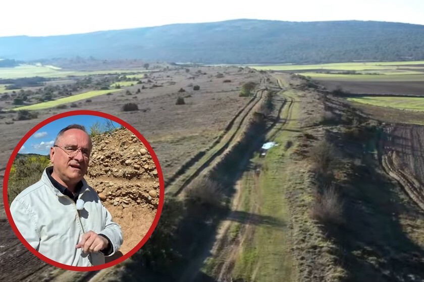
In the northern part of Burgos there is a road that has been there for about 2,000 years: 1,600 meters of an ancient Roman road that are still virtually intact in the Valle de Losa. The engineer and historian specializing in Roman engineering, Isaac Moreno Gallo, identified it in 2009 and since then he has been clear: “It is a road that is probably the best-preserved in Spain.”
But those 1,600 meters are only a small part of the original route, which ran about 115 km and connected Castro Urdiales (the ancient Flaviobriga) with Osma de Álava, formerly Uxama Barca. This road was part of the immense network that the Romans extended across their territories: by around AD 150, it totaled about 300,000 km of paved roads and paths, an infrastructure essential for moving people, goods, and armies throughout the Empire.
The Romans did not build the roads the way they appear in movies
When we imagine a Roman road, the typical image that comes to mind is a route formed by large stone slabs… but this does not reflect how these Roman roads were built outside cities. In the Valle de Losa, an archaeological trench in 2010 allowed us to verify that the surface was formed by different layers of stones, fine aggregates, sands, and compacted clays.
Moreover, in some spots, the material package rested directly on the rock and reached a considerable thickness. On that foundation, an elevated platform, supported by an embankment of more than a meter in height was built. The road reached a width of about 6.35 meters, more than enough for two carts to pass each other without issue.
It wasn’t simply a dirt road or a set of slabs: that structure was designed to withstand the continuous flow of carts loaded with people and goods and to keep a stable surface throughout the year. And there is an irrefutable proof of how well that engineering worked: two thousand years later, the route remains straight and its surface continues to resist rain and snow without the puddles or soft spots that appear on nearby roads.
Even the wheel tracks remain clear because some tractors still use the ancient road.
The road survived because for centuries no one knew what it was

The most astonishing aspect of this story is not that a Roman road has reached the 21st century in Spain, but why. Until the 1980s, more than 7 km of this same route were preserved in the Valle de Losa, but land consolidation wiped out a large portion of the alignment. The 1,600 meters that remain today were not intentionally protected; they simply fell outside the planning.
Moreno Gallo pointed to the problem: “No one was able to identify a Roman road.” For a long time, these infrastructures were confused with rural paths and were not taken into account in territorial transformations. The expert himself says that the Valle de Losa stretch has been preserved “by chance.”
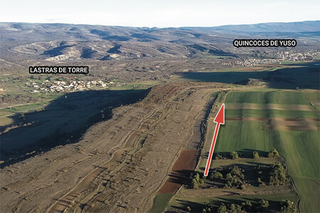
In total, this Roman road stretched about 115 km from the Cantabrian Sea to the inland peninsula, crossing the Valle de Mena, the Junta de Traslaloma, and the Valle de Losa before reaching Osma de Álava. Other traces of its route can still be found, and in areas transformed by cultivation, the ancient path can be followed from the air for several kilometers thanks to the stones left in the ground.
Today the Valle de Losa Town Hall is working on its signage, and a circular route of about 7.5 km allows visitors to explore the surroundings and reach the best-preserved stretch.
Images | Isaac Moreno Gallo